Local History
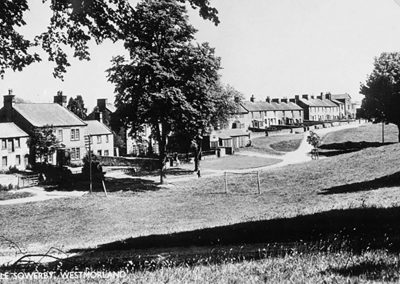
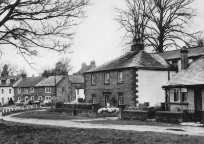
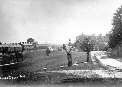
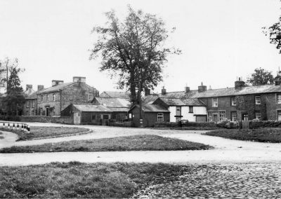
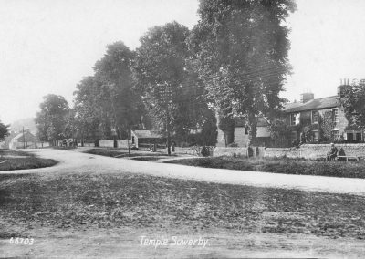
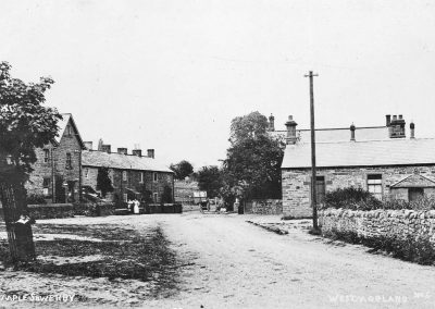
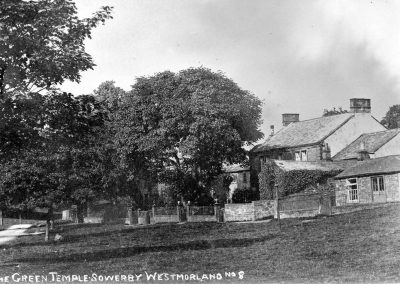
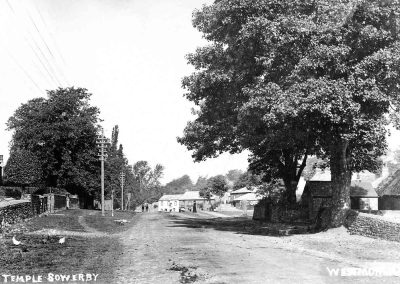
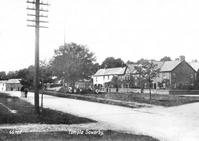
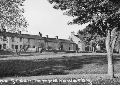
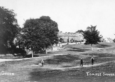
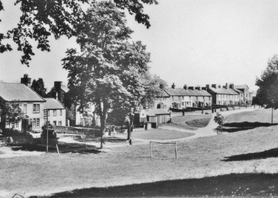
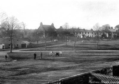
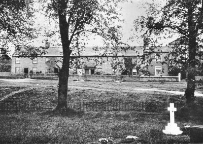
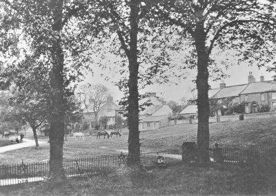
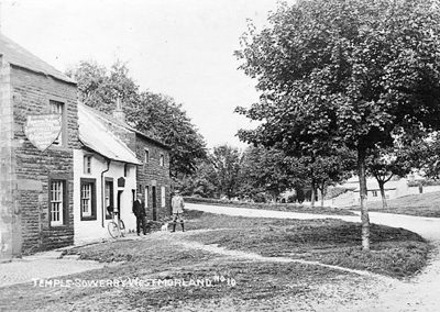
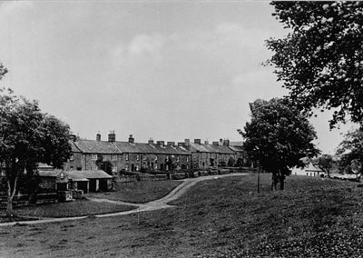
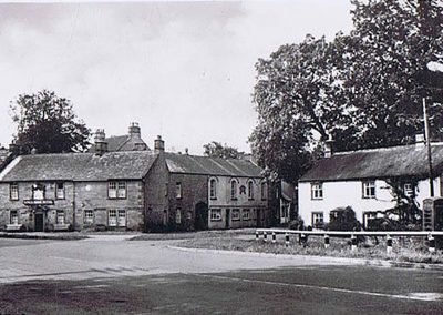
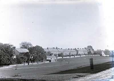
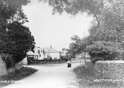
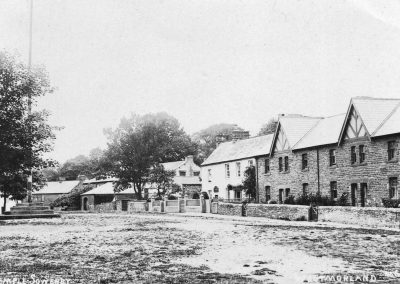
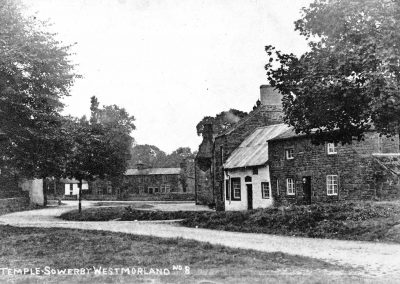
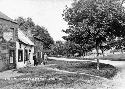
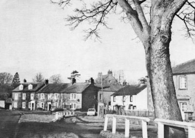
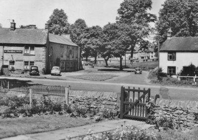
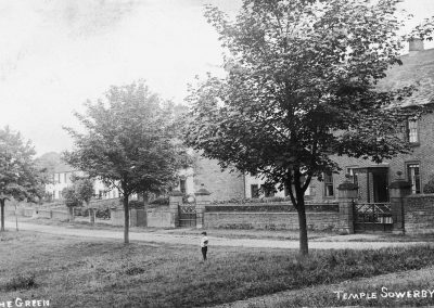
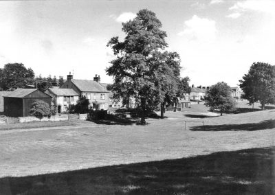
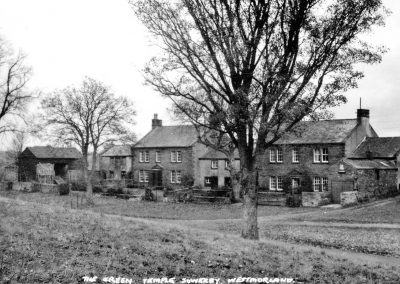
Known as the ‘Queen of Westmorland’ the red sandstone Village of Temple Sowerby is situated in the Eden Valley between the Pennines and the northeastern edge of the Lake District National Park. Beside the A66 trans-Pennine route, it is approximately 7 miles east of Penrith and 7 miles northwest of Appleby-in-Westmorland. Nearby the River Eden is joined by Crowdundle Beck to the north and the River Lyvennet to the south of the village. The attractive village centre is a mixture of tightly-knit buildings arranged around informal greens with further development along the “old A66”. The surrounding landscape consists mainly of enclosed agricultural pastures with some woodland. Historically Temple Sowerby grew as an important residential village on lines of major communication, first the road and then the now closed railway. This is reflected in many of the fine houses in the village today. These lines of communication gave rise to a large number of varied businesses, many of which have now gone. Today the village is a mixed farming, working and residential community with its inhabitants comprising an integral blend of long established locals and those whose roots were elsewhere.
Early Times
Temple Sowerby lies along the Roman route through the Eden valley. The Roman fort at Kirkby Thore (Roman Bravoniacum) is two miles away and the fort at Brougham (Roman Brocavum) six miles west. Though there was not known to be a settlement here at that time, a significant Roman milestone is in situ by the “old A66” on the south eastern outskirts of the village. In the 9th and 10th centuries Vikings settled extensively in the Eden Valley alongside some of the earlier settlements of the Anglo- Saxons. It is around this period that some sort of settlement at Temple Sowerby may have had its origins. The name of the village comes from the Danish word Saurby (“saurr” being mud and “býr” being farm or settlement).
The Medieval to Stuart Period
The manor of ‘Soureby’ was given to the Knights Templar in 1228 and the prefix of Temple was added to the village name as evidenced in documentation from 1279. The order of the Knights Templar was dissolved in 1312 and the manor passed in 1323 to the Knights Hospitallers who in turn were dissolved in 1545. The manor was sold by the Crown to the Dalston family in 1544. Acorn Bank, the former Manor House, dates from at least the late 16th century, but there may be some earlier mediaeval fabric dating from the times of the Templars. This house lies away from the main village to the north.
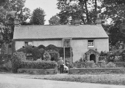
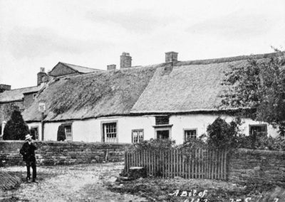
The village settlement of Temple Sowerby would have continued to develop through the mediaeval period and the form of the village today, being a mainly rectangular layout with buildings grouped around a central green and strip fields radiating out from the village, displays a form associated with the 13th and 14th centuries. Ordinary buildings of the mediaeval period would most probably have been of the cruck-framed style, with walls of rough stone and clay and roofs probably thatched. Black Swan House (dating from pre-Elizabethan times – 1558 to 1603) today incorporates an earlier cruck-frame. This house, Swan Cottage and Lowthian Cottage were once thatched. Eden Bridge was rebuilt in 1575 by subscription. This was an important crossing point on a major route. Also in the 16th century a farmhouse was built where Temple Sowerby House now stands and it is believed that the present coach house dates from that period.
Lady Anne Clifford, daughter of George Clifford the 3rd Earl of Cumberland (1558 – 1605), purchased an estate in Temple Sowerby in 1656. Countess Farm here in the village was part of that estate.
First records relating to Temple Sowerby School were in 1672.
Georgian & Victorian Times
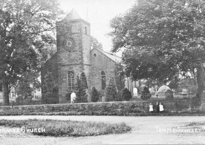
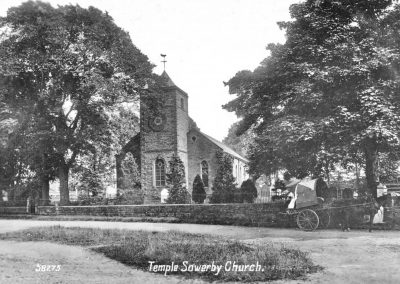
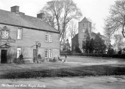
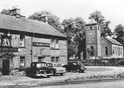
The present church in the village, St James’s, was rebuilt and greatly enlarged in 1770 and restored in the 1870s.
The 18th century witnessed the advent of Methodism, an evangelical Christian movement. John Wesley preached in the open air from a stone on the village green, possibly in 1786 while travelling from Appleby to Penrith. Methodism was practised in the village at cottage meetings and also in a building adjoining Tendot Barn until Temple Sowerby Chapel was built in 1872 at a cost of £693. The adjacent Sunday School building was opened in 1880. Both are now private dwellings.
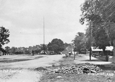
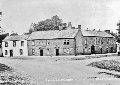
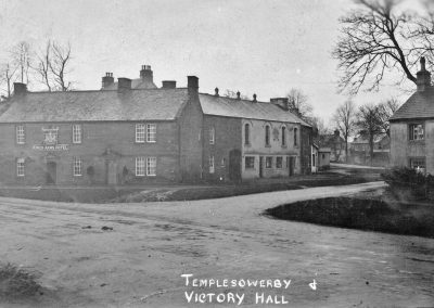
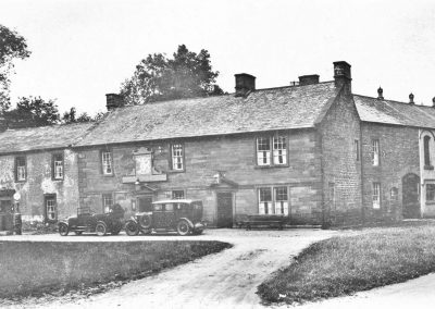
During the latter part of the 18th century a turnpike road was built between Penrith and Darlington, later to be the A66. A turnpike road was maintained with funds from a toll from the road users. In Temple Sowerby the toll was just east of Templars Court. Temple Sowerby was one of the stops along this road that provided stabling for horses at The Kings Arms Hotel.
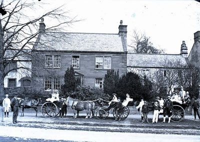
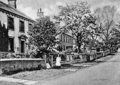
The turnpike road improved communications which resulted in the growth of the village as a trading centre. This increased prosperity brought gentry to the village and generally heralded the building of many of the fine 18th and 19th century houses which we see today, such as The Grange, Beech House, Sheriff House, Linden House and part of the existing Temple Sowerby House Hotel.
You can view Temple Sowerby Conservation and Character Appraisal and Management Plan 2020 giving details of such properties.
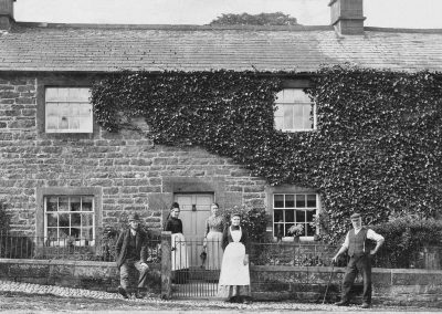
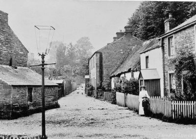
Building continued in Temple Sowerby throughout the nineteenth century with many buildings continuing to be constructed of traditional red sandstone under Westmorland Green slate roofs. Welsh slate was used in some cases and for some buildings, especially along the A66, brick was used.
In the early years of the 19th century four large annual sheep and cattle fairs were established in the village. Villages needed to be self-sufficient and there was a need to manufacture and retail goods locally. The road and railway links made Temple Sowerby a thriving centre for many local industries. For example, there was a shirt maker, a tailor, a clog maker, a cabinet maker, a joiner, a wheelwright, masons and smiths. There was also a thriving tanning industry with premises behind Woodbine House, in Joiners Yard and at the buildings now known as 1 & 2 Old Tannery. Gypsum was also a significant feature of the local economy, the extraction of which has been recorded at the Acorn Bank quarry from at least 1790. A cottage industry relating to gypsum was mentioned in the County Directory of 1875 and the mineral is still mined at Kirkby Thore’s British Gypsum plant.
The Early 20th Century
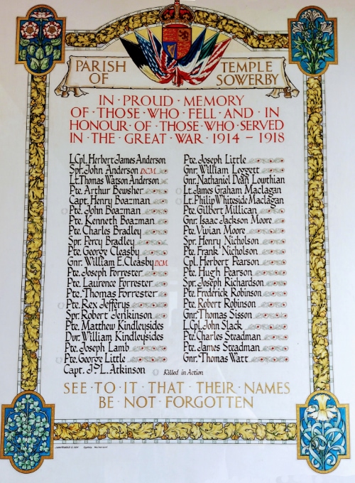
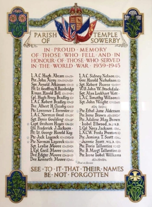
The two World Wars affected the village in the same way as many villages throughout Great Britain. The service of residents to their country and the tragic loss of some of those, is reflected in the memorials in the Parish Church, Wesleyan Chapel and Victory Hall. The Victory Hall was purchased for the village by public subscription in 1922 as a memorial to the 1914/18 war.
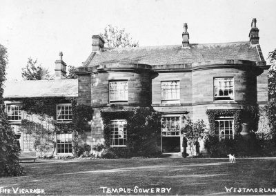
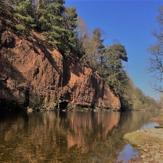
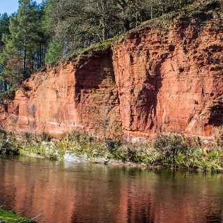
During the 1939/45 War Child evacuees came to the village from Newcastle Upon Tyne and a barn behind the then vicarage was converted to a schoolroom for their lessons. Iron railings around the Churchyard, as well as from some other properties in the village, were removed to help the war effort. The local Home Guard had a shooting range by the River Eden at Oglebird Scar (Red Rock) and evidence can be seen today of two fairly large holes in the red sandstone where hundreds of bullets – 303 and sten gun – did their damage.
Post War Change
Electrification of the village was completed just before Christmas 1947 when Park House Farm was the first home to be connected. A residential estate was built at Croft Place by the local Council in the 1940s. It has been enlarged twice, in the 1950s and 1970s. Other residential developments have been built, Linden Park commenced in the late 1990s and extended in 2019 and Eden Meadows in 2000. There have been other smaller housing sites and barn conversions around the village. In 2021 Eden Valley Crematorium opened at the site of a redundant farm on the outskirts of the village.
Before nationwide County Boundary changes, Temple Sowerby was in the County of Westmorland. In 1974 the Counties of Cumberland and Westmorland were combined to form the greater part of the new County of Cumbria. Reorganisation in 2023 will return the village to the Westmorland and Furness Council area.
Millenium
To commemorate the Millenium, Temple Sowerby was chosen as a site for one of the ten Millennium Benchmarks along the River Eden. Victoria Brailsford created the sculpture whilst artist in residence at Acorn Bank. It is a series of spheres on a terraced base made from Lazonby Sandstone. Sited on a high embankment overlooking the River Eden, it is an elevated place to view the River Eden and hills beyond. Now that the A66 bypass has been constructed there is also a fine view of the bridge that spans the River Eden. You can reach the sculpture, named “Red River”, via the footpath at the edge of the Cricket Pitch. The sculpture was commissioned by the National Trust in collaboration with the East Cumbria Countryside Project. It was unveiled on 26th February 1999.
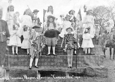
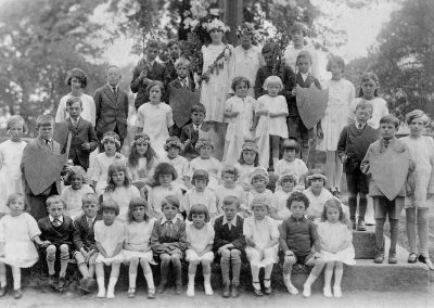
The Millenium also heralded the replacement of the Maypole which had stood on the Maypole Green since 1817. There was a dedication ceremony, partying and the school children buried a time capsule.
The Bypass
The A66 initially brought prosperity and employment but with the increase in road use it eventually divided and became a serious hazard to residents of the village. The account of the long emotive campaign for a Bypass spanning many years, its eventual construction and opening in 2007 is detailed on a separate page.
Dr Ainscow
Dr. Donald Ainscow worked as a family doctor in Temple Sowerby from 1950 until his retirement in 1987. Known to all as ‘Dr. Donald’, he served the village as its doctor and on the Parish and Church Councils. He died in 2014 and a tree was planted in his memory in 2016 on the village green very close to the house where he and his family lived. Money raised in memory of Dr Ainscow also contributed towards the purchase of a defibrillator and cabinet which has been placed at the Victory Hall, in Temple Sowerby. A further £728 of the funding for this was raised by Caitlin, who fearlessly completed the Via Ferrata at Honister slate mine when she was only 10 years of age.
The Village Today
As you walk around the village today you can see reminders of the past in many of the house names – Smithy House, Tannery Cottages, Joiners Yard and Black Swan House are all examples of present day names which reflect the nature of the village in the past. Although the village lost its railway in 1962, it is just seven miles from the main west coast line railway at Penrith and 5 miles from The Carlisle to Settle Railway at Langwathby. There is also good road communication with the A66 linking closely to the M6 motorway at Penrith. Today, Temple Sowerby is a lively and busy community which has seen many changes without losing its character and sense of identity. The people of the village and surrounding area continue to join together in a variety of social, sporting and cultural events.
Facts and Figures
Temple Sowerby = Muddy/sour-ground farm/settlement’. At one time held by the Knights Templar.
Sowerby – saurr (Old Norse) Mud, dirt, sour ground – bȳ (Old Norse) A farmstead, a village.
Population
1801 – 299
1841 – 381 There were 82 houses recorded with 7 of them being uninhabited.
1871 – 476
1971 – 279
2000 – 312 (248 adults, 64 children)
2001 – 330
2011 – 528 in 236 households (includes Newbiggin)
Cumbria Archive Centre, Kendal
Parish registers from 1669
Bishop’s Transcripts from 1774
Newbiggin’s History
Newbiggin, Temple Sowerby, is a small hamlet with 40 properties in the Parish, mainly of Sandstone and Slate construction. It has a long history shaped by agriculture, the railway and mining. Today there are three working farms in the Parish, Newbiggin Hall Farm, Williamsgill Farm and Black Leases Farm. A fourth, Town End Farm, in the centre of the village, is now a private house and the adjoining barns have been converted into dwellings, or developed into new houses. A fifth, Moorlands Head Farm is now owned and operated as a cattery and kennels by Eden Animal Rescue.
Newbiggin Hall Farm was previously part of the Newbiggin Hall estate. The Hall entrance stands at the village crossroads which connects Temple Sowerby to Milburn and Culgaith to Kirkby Thore. The Hall has its origins as a Pele tower built in the 13th century, which has been much extended since with extensive gardens and outbuildings, – originally being a coach house, stables and grooms quarters. Also within the portals of The Hall stands St Edmunds church, a Norman church rebuilt and with a fine carved screen from the 14th century. The graveyard hosts a spectacular display of snowdrops in Spring.
Opposite The Hall is an attractive village green with adjoining properties that date back to the 17th century, including a former hunting lodge and farm worker cottages. Also near the crossroad is Newbiggin Reading Room, attached to Corner House. This was formerly the village school room which closed over fifty years ago and has since been used informally as the village hall. The freehold was purchased in 2015 by the Newbiggin Recreation on behalf of residents and was totally refurbished a year later. For many years Newbiggin Recreation has organised social events in the village and today also manage and hire the Reading Room as a community hall.
Beyond the Church, a bridge over Crowdundle Beck marks the northern boundary of the village. It was formerly the division between the counties of Cumberland and Westmorland, Newbiggin being in Westmorland. A very attractive footpath downstream along the beck leads to Acorn Bank House, Mill and Gardens. Upstream of the bridge Newbiggin Mill, once a flour mill, is now a private house.
The Settle to Carlisle railway line runs along the opposite edge of the village. The station at Newbiggin was closed in 1970 but when opened in 1876 was very busy as evidenced by Railway Cottages that were built to accommodate porters fetching people and goods to the station, including stone from Culgaith quarry. Today, the Station and Station Master’s House are private dwellings as are the four Railway Cottages. Beyond the railway line Newbiggin mine has now closed and been re-landscaped back to pastureland. It was one of several Gypsum mines in the area, with underground tunnels leading to Kirkby Thore.
With thanks to the Millennium Book Committee for allowing us to reproduce some of the information from the book.
